Log in
All resources
Create a design
Tools
7,171 Free Images of Atlas Map
historical
maps in the library of congress
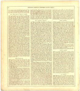
pennsylvania
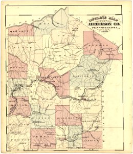
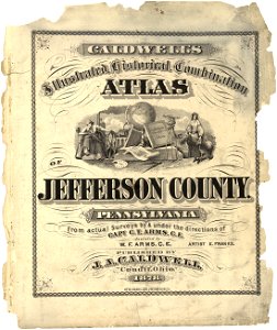
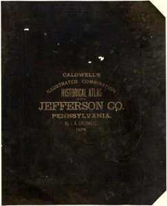
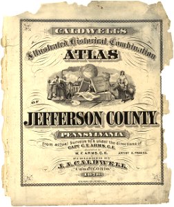
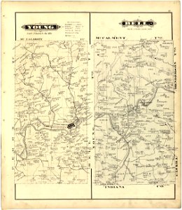
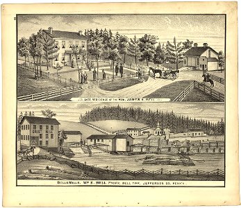
caldwell's illustrated
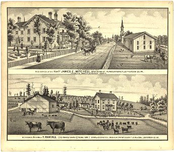
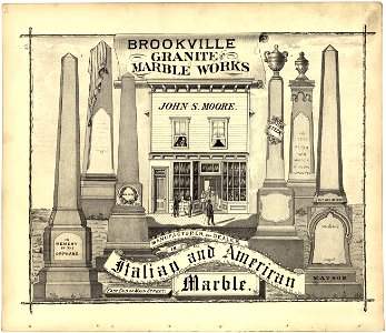
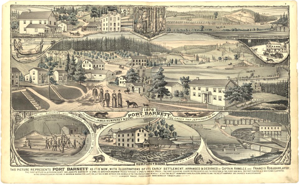
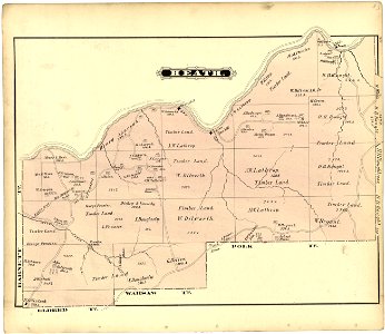
combination atlas of jefferson county
national library of poland
maps from géographie illustrée de la france et de ses colonies
beschreibung und contrafactur der vornembster stät der welt, liber primus civitates orbis terrarum
maps from university of amsterdam special collections
atlas der neederlanden
pennsylvania
historical
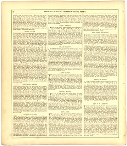
pennsylvania
historical
pennsylvania
historical
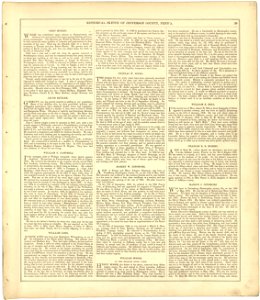
pennsylvania
historical
pennsylvania
historical
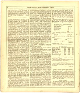
pennsylvania
historical
pennsylvania
historical
pennsylvania
historical
pennsylvania
historical
pennsylvania
historical
pennsylvania
historical
pennsylvania
historical
pennsylvania
historical
map of the german empire by louis stanislas d'arcy de la rochette
cartouches by louis stanislas d'arcy de la rochette
beschreibung und contrafactur der vornembster stät der welt, liber primus civitates orbis terrarum
maps of frankfurt (oder) by braun & hogenberg
beschreibung und contrafactur der vornembster stät der welt, liber primus civitates orbis terrarum
maps of tours by braun & hogenberg
beschreibung und contrafactur der vornembster stät der welt, liber primus civitates orbis terrarum
maps of famagusta by braun & hogenberg
beschreibung und contrafactur der vornembster stät der welt, liber primus civitates orbis terrarum
maps of sion by braun & hogenberg
beschreibung und contrafactur der vornembster stät der welt, liber primus civitates orbis terrarum
maps of marburg by braun & hogenberg
beschreibung und contrafactur der vornembster stät der welt, liber primus civitates orbis terrarum
maps of toledo by braun & hogenberg
pennsylvania
historical
pennsylvania
historical
pennsylvania
historical
pennsylvania
historical
pennsylvania
historical
pennsylvania
historical
pennsylvania
historical
pennsylvania
historical
pennsylvania
historical
pennsylvania
historical
pennsylvania
historical
pennsylvania
historical
pennsylvania
historical
pennsylvania
historical
pennsylvania
historical
pennsylvania
historical
pennsylvania
historical
pennsylvania
historical
pennsylvania
historical
pennsylvania
historical
pennsylvania
historical
pennsylvania
historical
pennsylvania
historical
pennsylvania
historical
pennsylvania
historical
pennsylvania
historical
pennsylvania
historical
pennsylvania
historical
pennsylvania
historical
pennsylvania
historical
maps of europe by mercator-hondius
ateliers bmb mercator
maps of south scotland by gerardus mercator
ateliers bmb mercator
illustration
maps
map of the german empire by louis stanislas d'arcy de la rochette
cartouches by louis stanislas d'arcy de la rochette
theatri praecipvarvm totivs mvndi vrbivm : liber sextvs (1618)
maps of york by braun & hogenberg
maps of africa by rumold mercator
ateliers bmb mercator
maps of iceland by gerardus mercator
ateliers bmb mercator
siege of bergen-op-zoom 1622
old maps of north brabant
gemeente atlas van nederland - south holland
maps of lange ruige weide
atlas maior, vol 2 (sweden, russia, poland, eastern europe, and greece) - joan blaeu, 1667 - bl 114.h(star).2
copper engraving print
map of maastricht by willem and johannes blaeu (1649)
statenkwartier (maastricht)
de praecipvis totivs vniversi vrbibvs, liber secvndvs (1612)
maps of kleve by braun & hogenberg
maps from university of amsterdam special collections
atlas der neederlanden
theatri praecipvarvm totivs mvndi vrbivm : liber sextvs (1618)
maps of heilbronn by braun & hogenberg
de praecipvis totivs vniversi vrbibvs, liber secvndvs (1612)
maps of wissembourg by braun & hogenberg
maps from university of amsterdam special collections
atlas der neederlanden
maps from university of amsterdam special collections
atlas der neederlanden
de praecipvis totivs vniversi vrbibvs, liber secvndvs (1612)
maps of neuss by braun & hogenberg
1808 in galicia (spain)
galiciana
de praecipvis totivs vniversi vrbibvs, liber secvndvs (1575)
maps of neuss by braun & hogenberg
map of maastricht by willem and johannes blaeu (1649)
history of wyck (maastricht)
atlas sive cosmographicae (gerardus mercator, 1607)
maps of east flanders by pieter van der keere
de praecipvis totivs vniversi vrbibvs, liber secvndvs (1575)
maps of kleve by braun & hogenberg
de praecipvis totivs vniversi vrbibvs, liber secvndvs (1575)
maps of wissembourg by braun & hogenberg
siege of breda 1624-1625
atlas van loon
gemeente atlas van nederland - north brabant
old maps of bergen op zoom
maps in the library of congress
old maps of antigua and barbuda
civitates orbis terrarum. de praecipuis totius universi urbibus. liber secundus
maps of kleve by braun & hogenberg
civitates orbis terrarum. de praecipuis totius universi urbibus. liber secundus
maps of wissembourg by braun & hogenberg
english-language maps
maps by john cary
cartouches by sanson family
pierre mariette i
gemeente atlas van nederland - utrecht
jacob kuyper
civitates orbis terrarum. de praecipuis totius universi urbibus. liber secundus
maps of neuss by braun & hogenberg
lawrence h. slaughter collection of english maps, charts, globes, books and atlases
novi belgii, atlas maior
19th-century maps of europe
maps by john cary
19th-century maps of europe
maps by john cary
background
maps
old maps of utrecht (city)
atlas van loon
maps from university of amsterdam special collections
atlas der neederlanden
maps of krimpenerwaard
atlas novus (blaeu)
maps by john cary
1799 maps
maps from university of amsterdam special collections
atlas der neederlanden
maps from university of amsterdam special collections
atlas der neederlanden
maps from géographie illustrée de la france et de ses colonies
maps from géographie illustrée de la france et de ses colonies
maps from géographie illustrée de la france et de ses colonies
maps from géographie illustrée de la france et de ses colonies
maps from géographie illustrée de la france et de ses colonies
maps from géographie illustrée de la france et de ses colonies
maps from géographie illustrée de la france et de ses colonies
4001 - 4100 of 7,171
Next page
/ 72


![Beschreibung und Contrafactur der Vornembster stät der Welt, liber primus [Civities of the World], 1574](https://cdn.creazilla.com/illustrations/10000573975/beschreibung-und-contrafactur-der-vornembster-st-t-der-welt-liber-primus-civities-of-the-world-1574-sm.jpg)
![Beschreibung und Contrafactur der Vornembster stät der Welt, liber primus [Civities of the World], 1574](https://cdn.creazilla.com/illustrations/10000639501/beschreibung-und-contrafactur-der-vornembster-st-t-der-welt-liber-primus-civities-of-the-world-1574-sm.jpg)
![Beschreibung und Contrafactur der Vornembster stät der Welt, liber primus [Civities of the World], 1574](https://cdn.creazilla.com/illustrations/10000713400/beschreibung-und-contrafactur-der-vornembster-st-t-der-welt-liber-primus-civities-of-the-world-1574-sm.jpg)
![Beschreibung und Contrafactur der Vornembster stät der Welt, liber primus [Civities of the World], 1574](https://cdn.creazilla.com/illustrations/10000920445/beschreibung-und-contrafactur-der-vornembster-stt-der-welt-liber-primus-civities-of-the-world-1574-sm.webp)
![Beschreibung und Contrafactur der Vornembster stät der Welt, liber primus [Civities of the World], 1574](https://cdn.creazilla.com/illustrations/10001065727/beschreibung-und-contrafactur-der-vornembster-st-t-der-welt-liber-primus-civities-of-the-world-1574-sm.jpg)
![Beschreibung und Contrafactur der Vornembster stät der Welt, liber primus [Civities of the World], 1574](https://cdn.creazilla.com/illustrations/10000259768/beschreibung-und-contrafactur-der-vornembster-stt-der-welt-liber-primus-civities-of-the-world-1574-sm.webp)


![The Empire of China: to serve the history of the European establishment / by N. Bellin ingr. order of the Navy in 1748; J.V. Schley direct, Jakob van der Schley, [1773]](https://cdn.creazilla.com/illustrations/10000709534/the-empire-of-china-to-serve-the-history-of-the-european-establishment-by-n-bellin-ingr-order-of-the-navy-in-1748-j-v-schley-direct-jakob-van-der-schley-1773-md.jpg)
![Caarte vande polders van Onwaart and Aerts Dyck Wal / Heyman vander Dyck fecit; I. Stemmer's sculpsit; A. Steyaart invented; I. Shutters fecit cum aqua forti, Romeyn de Hooghe, [1701]](https://cdn.creazilla.com/illustrations/10000236419/caarte-vande-polders-van-onwaart-and-aerts-dyck-wal-heyman-vander-dyck-fecit-i-stemmers-sculpsit-a-steyaart-invented-i-shutters-fecit-cum-aqua-forti-romeyn-de-hooghe-1701-md.jpg)


![Caarte vande polder van Rockxsennisse 1696 / Heyman van Dyck fecit; I. Stemmers sculpsit; A. Steyaart invenit; I. Luiken fecit cum aqua forti, Romeyn de Hooghe, [1701]](https://cdn.creazilla.com/illustrations/10000928428/caarte-vande-polder-van-rockxsennisse-1696-heyman-van-dyck-fecit-i-stemmers-sculpsit-a-steyaart-invenit-i-luiken-fecit-cum-aqua-forti-romeyn-de-hooghe-1701-md.jpg)


![Caarte vande heerlykheyt van Melis Sant 1696 / Heyman van Dyck fecit; A. Steyaart invenit; I. Luiken fecit cum aqua forti; I. Stemmers sculpsit, Romeyn de Hooghe, [1701]](https://cdn.creazilla.com/illustrations/10001255695/caarte-vande-heerlykheyt-van-melis-sant-1696-heyman-van-dyck-fecit-a-steyaart-invenit-i-luiken-fecit-cum-aqua-forti-i-stemmers-sculpsit-romeyn-de-hooghe-1701-md.jpg)
![Caarte vande Oude Tonge inde heerlykheyt ende lande van Grysoort / Heyman vander Dyck fecit; I. Luiken fecit cum aqua forti; A. Steyaart invenit; I. Stemmers sculpsit, Romeyn de Hooghe, [1701]](https://cdn.creazilla.com/illustrations/10001504090/caarte-vande-oude-tonge-inde-heerlykheyt-ende-lande-van-grysoort-heyman-vander-dyck-fecit-i-luiken-fecit-cum-aqua-forti-a-steyaart-invenit-i-stemmers-sculpsit-romeyn-de-hooghe-1701-sm.jpg)


